Height calibration
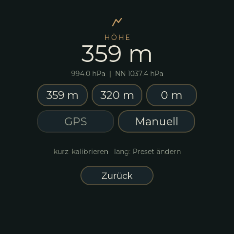
The BME280 measures air pressure; the height is derived from it and a reference pressure at sea level (QNH). Weather changes that pressure, so the height drifts and has to be set again now and then at a place whose height you know. Settings → Höhe:
| Button | Does |
|---|---|
| Three presets (default 359 m, 320 m, 0 m) | Tap: calibrate to the preset height. Long press: change the preset (number entry). |
| GPS | Calibrates to the height above sea level of TrailBridge's GPS fix. Greyed out without a current fix. A phone GPS is only good to about 10 m vertically -- a rough start, not a replacement for a known place. |
| Manuell | Number entry: the known height (m), or switch to the reference pressure at sea level (hPa, 850 to 1090), e.g. from a weather report. |
The page shows the height, the measured pressure and the reference pressure. The result of the last action stays on the line below the buttons for a few seconds.
Web page
/sensor/ has the same: the presets (button and field to change), GPS, a known height and a
reference pressure. The routes also work for scripts (GET, answer OK or the reason):
/sensor/cal?preset=0..2     /sensor/cal?gps=1
/sensor/cal?height=<m>      /sensor/cal?qnh=<hPa>
/sensor/preset?i=0..2&height=<m>
Notes
- Reference pressure and presets are stored as one NVS blob (
Sensors/HeightCal), written by the next BME280 cycle, not by the caller. An older single value (RefPressure) is still read. - GPS height needs the tag
MSL_ALTITUDE_DM(0x0E) of the protocol and Android 14 or later on the phone.ALTITUDE_Mis above the ellipsoid (about 47 m off in Germany) and is not used. Made-up positions (GPX test ride) are refused. - Code:
I2CSensors::calibrateHeight()and friends, displaysrc/ui/RimRidgeAltCustFunc.*(EEZ pagesRimRidgeSettingsAlt,RimRidgeSettingsNum), web routes insrc/WifiWebserver.cpp.